Text types: Text formats for presenting information
| Maps & legends |
Using maps
Maps provide information about 'spaces' in a diagrammatic form. Because the information is visual, maps are usually easy to understand and provide a good stimulus for speaking, listening and writing in English.
There are many different types of maps, eg:
| maps that show political boundaries | |
| maps that show geographical features | |
| maps that show interesting landmarks | |
| maps that show streets and roads |
All of these can be used to teach English while also teaching map-reading skills and geographical knowledge.
Here are some suggestions for using maps in the classroom:
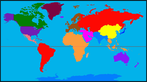
Bring a map of the world into the classroom and ask students to come out and point to features such as:
|
|
Focus on one particular country or region, eg Hong Kong:
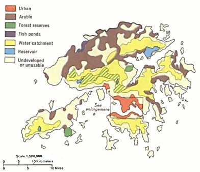 |
Give each student a map which includes a compass, scale and legend (eg symbols indicating rivers, railways, main roads, mountains, swamps, main cities, minor cities, borders). Ask students to read the symbols in order to participate in a quiz, with questions such as the following:
| Which is the tallest mountain in Hong Kong? | |
| Which city is on the border between China and Hong Kong? | |
| Is Lantau island to the east or west of Hong Kong island? | |
| Name two cities joined by the KCR. | |
| How far is it from Shatin to Tsim Sha Tsui? |
More advanced students could make up their own questions to ask their classmates.
Create or copy a map of a particular neighbourhood or area. (It can even be imaginary.) Then get your students to locate certain features by listening to a description, eg:
| "There is a house on the island. Draw the house by
listening carefully to the description: The house is in the north of the island. It is between the forest and the river, at the foot of the mountain. To reach the house, you need to follow the road. Draw the road on the map. The road starts at the harbour on the west coast of the island. It goes north along the coast, passing two mountains. It goes behind the third mountain and around to the house." |
|
For PrimeTeach teaching materials which include activities involving maps
see:
![]() Using and creating maps
Using and creating maps
![]() Postcards 1
Postcards 1
![]() Postcards 2
Postcards 2
![]() Postcards 3
Postcards 3
|
||
To give us feedback about this section, click here or on the Comment button at the top of the screen.
If you have any questions about this section, visit the Language Corner.
If you have any questions or suggestions about how to teach this section, send a message to the Teaching Corner.